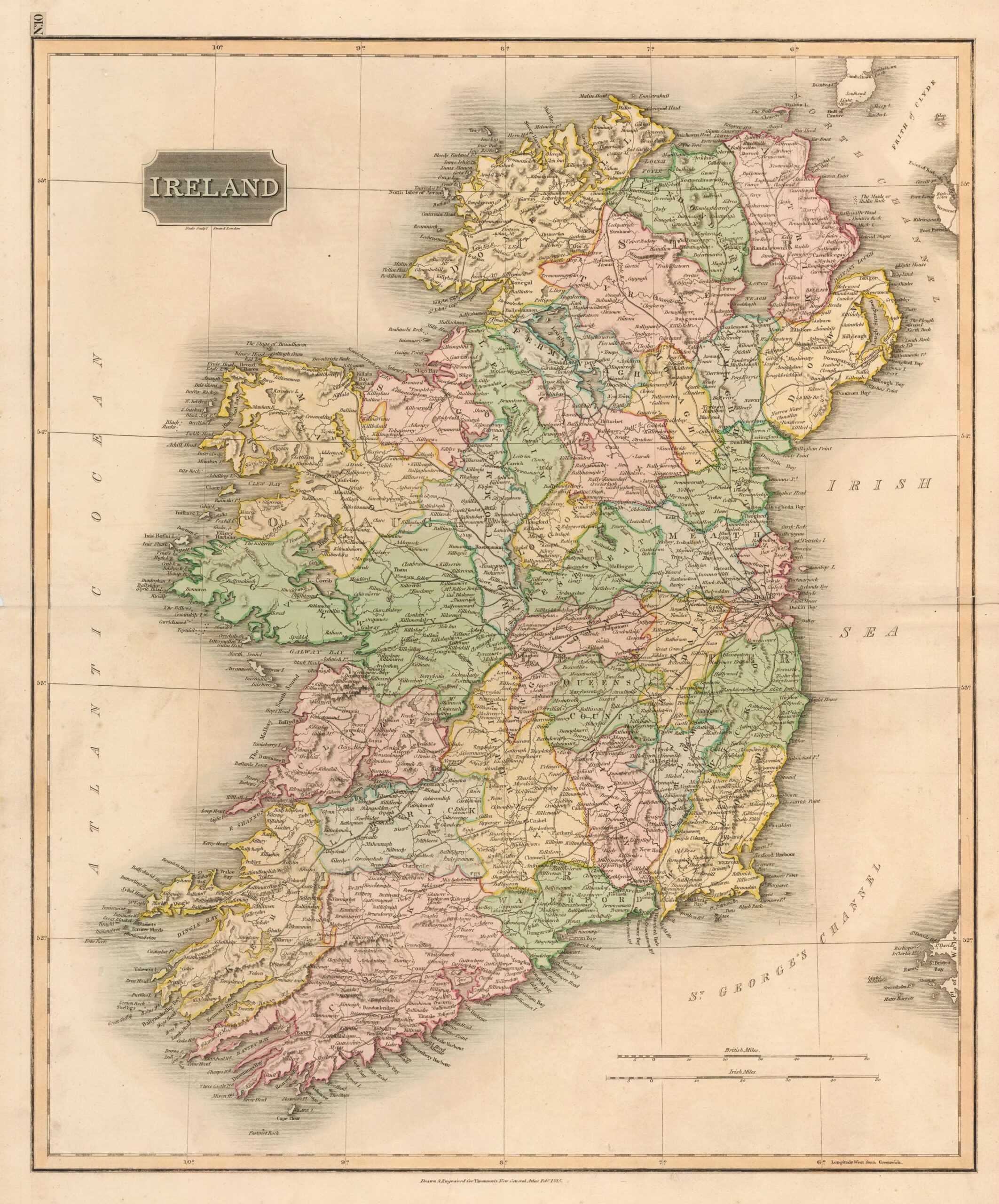
This beautifully engraved map of Ireland was published in Edinburgh in 1815 by the Scottish cartographer and publisher John Thomson. Measuring approximately 23.5 × 19.5 inches (59.7 × 49.5 cm), it depicts the island in its entirety and uses colour to distinguish the individual counties.
The map reflects the restrained English cartographic style of the early nineteenth century. Relief is shown by hachures, while towns, cities, roads and major topographical features are carefully identified. Rather than relying on elaborate decorative cartouches or fanciful imagery, Thomson emphasized clarity, detail and geographical accuracy.
John Thomson (1777–1841) was a prominent Scottish cartographer, publisher and bookbinder based in Edinburgh. He had apprenticed under the bookbinder Robert Alison and later became one of the leading figures in the Edinburgh school of cartography. Along with contemporaries such as John Pinkerton and John Cary, Thomson helped reshape European mapmaking by replacing much of the ornamental style of the eighteenth century with a cleaner and more informative approach.
This image is reproduced under a Creative Commons licence. Please refer to the original image page for the full attribution and licence terms.
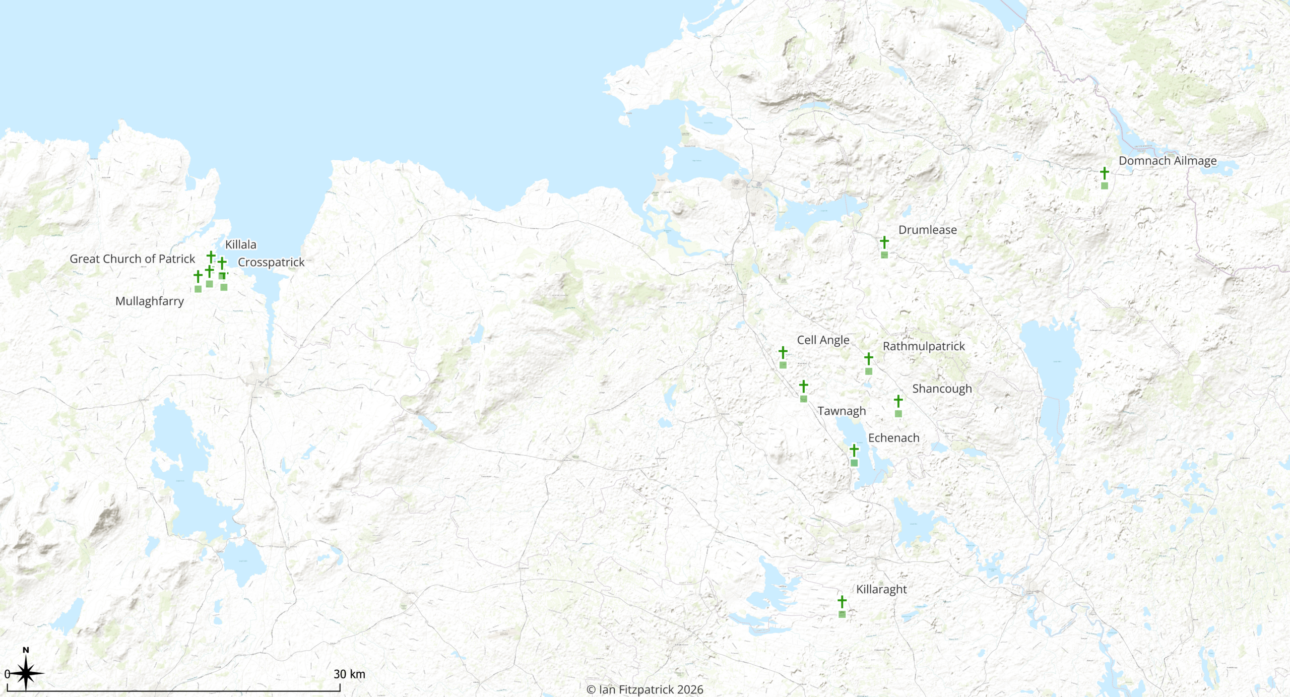
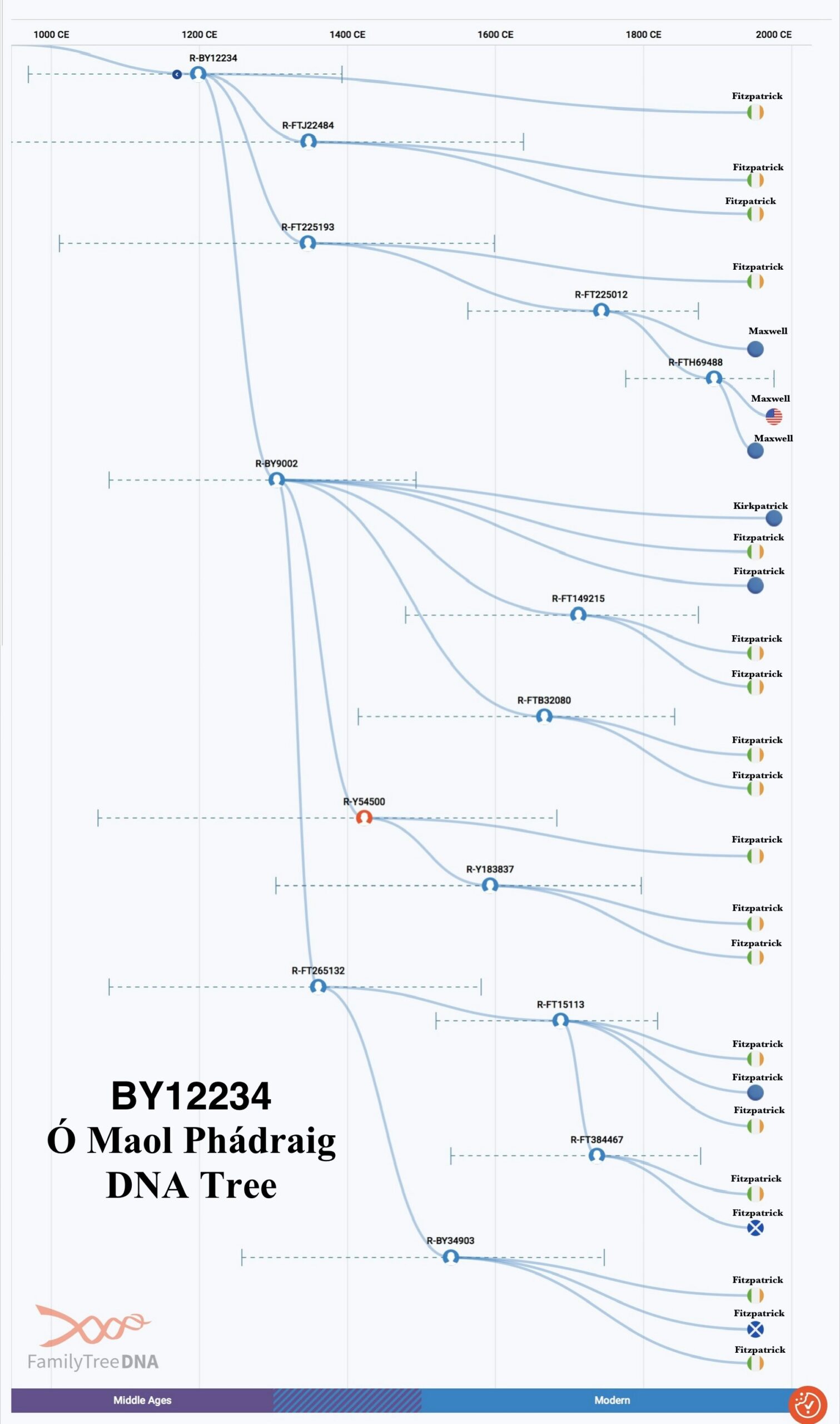
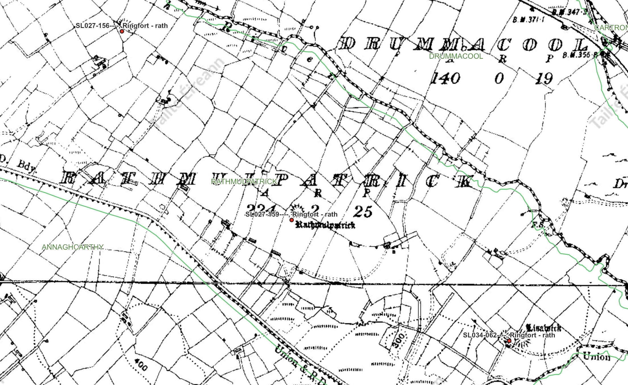
Selected early churches and ecclesiastical sites associated with the Patrician tradition between Killala Bay, southern Sligo, northern Roscommon and Leitrim. The identifications are based principally upon Tírechán and related material preserved in the Book of Armagh. Some locations are secure, while others remain proposed or uncertain. Map by Ian Fitzpatrick, 2026.The BY12234 Ó Maol Phádraig Y-DNA tree. The chart shows the major paternal branches descending from R-BY12234, with estimated formation dates and confidence ranges, and the modern surnames and reported ancestral origins of tested descendants. Nearly every surviving branch is represented by men named Fitzpatrick, indicating a substantial shared paternal lineage that began diversifying during the medieval period and continued into several distinct modern family lines. Rathmulpatrick on a nineteenth-century Ordnance Survey map, overlaid with archaeological information from the National Monuments Service Historic Environment Viewer. The red marker identifies the central circular earthwork as recorded ringfort SL027-159. The underlying map preserves the older field pattern and the townland name Rathmulpatrick, while the archaeological record confirms the presence of a surviving rath rather than leaving its existence to be inferred from the placename alone. Other ringforts recorded nearby show that it formed part of a wider early medieval settlement landscape.
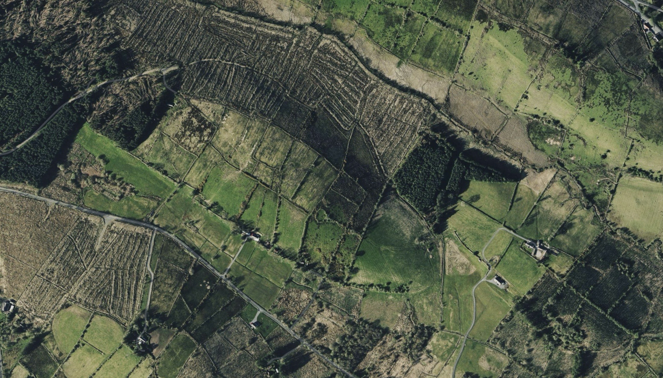
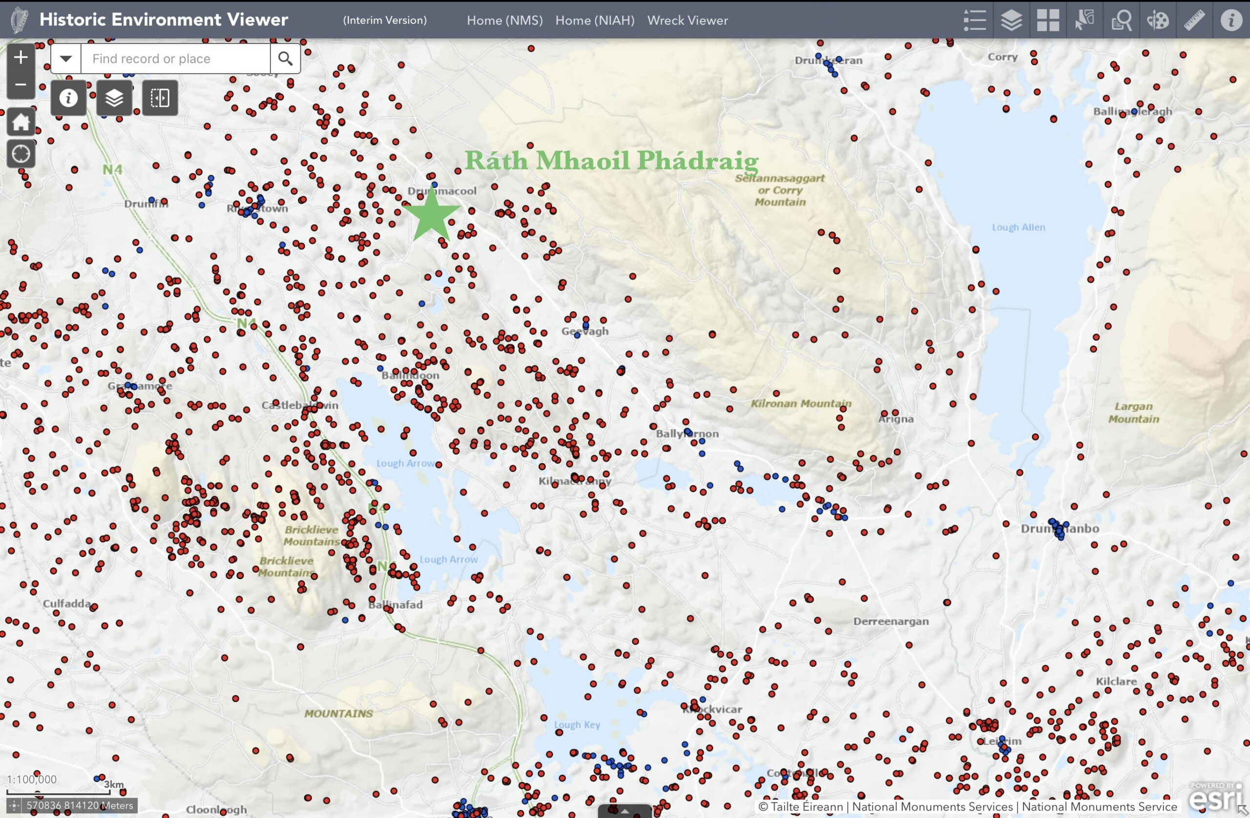
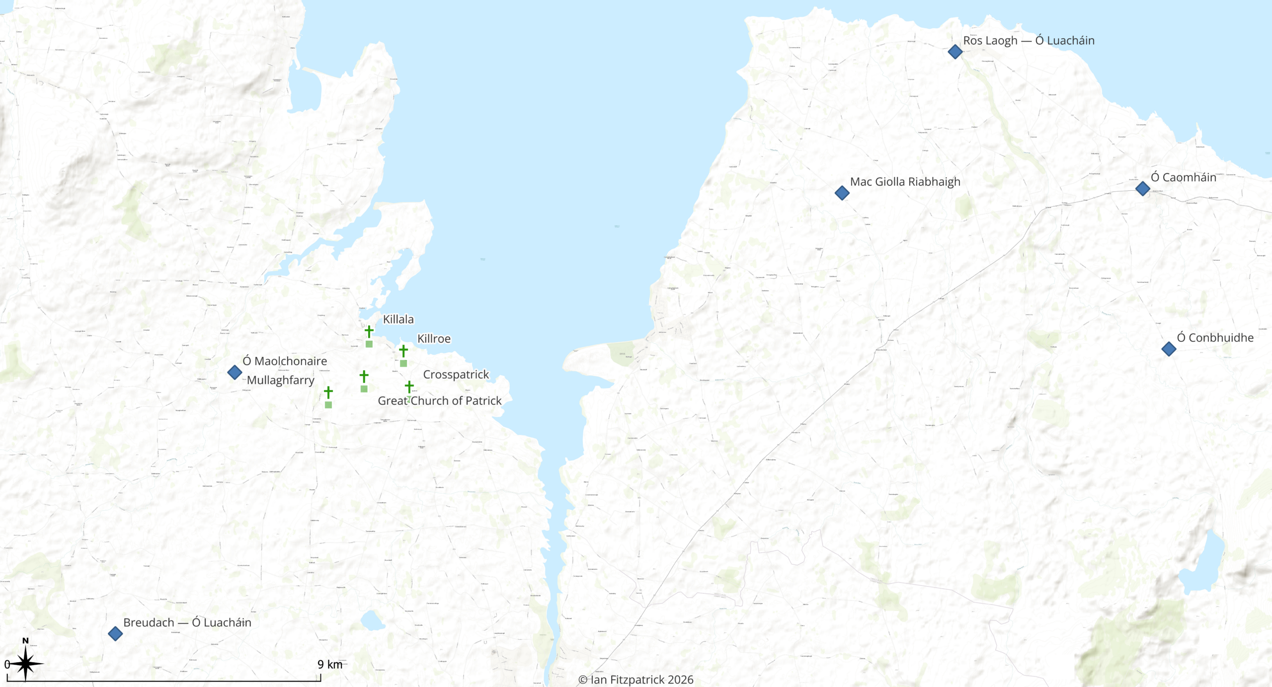
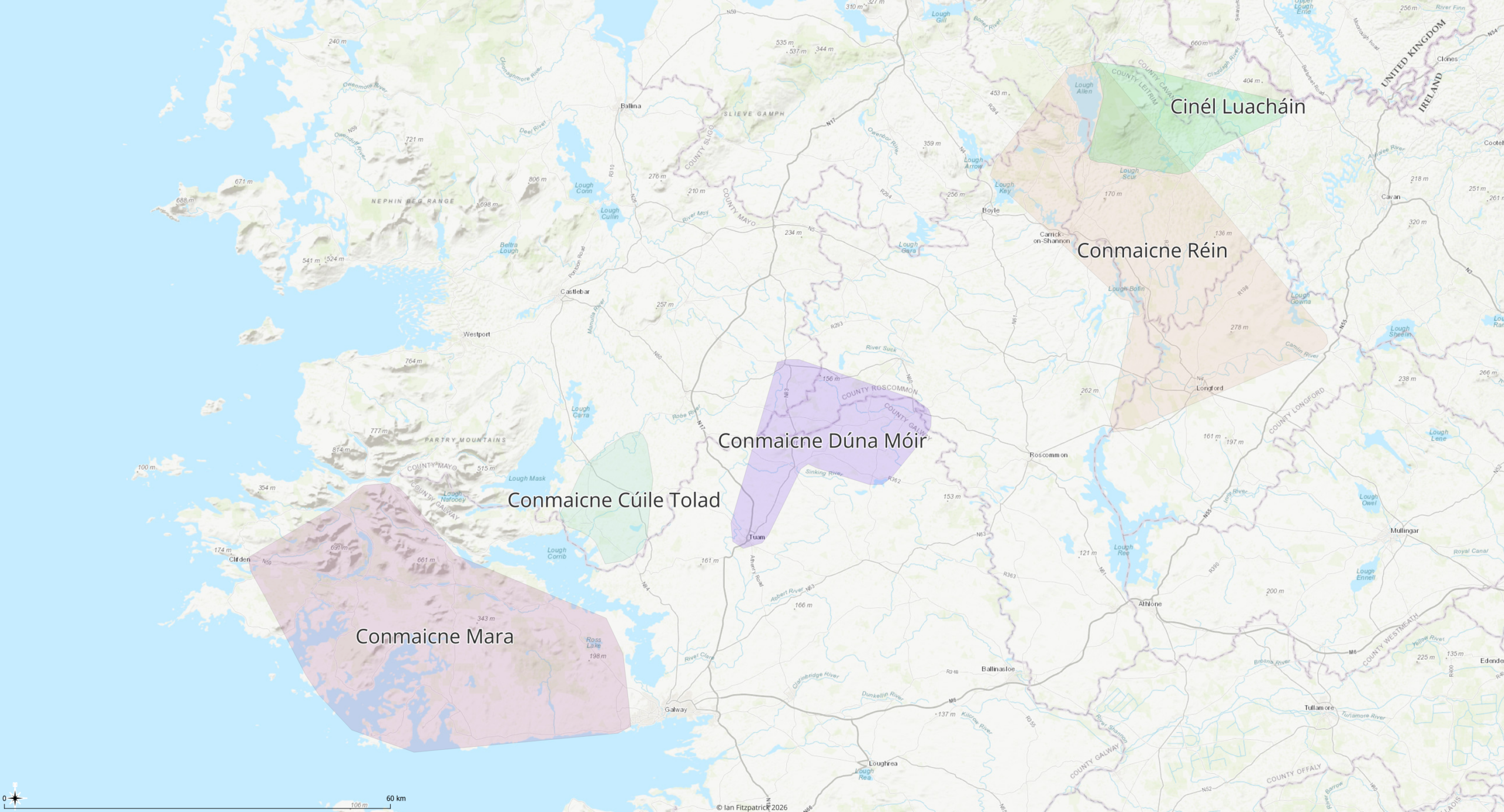
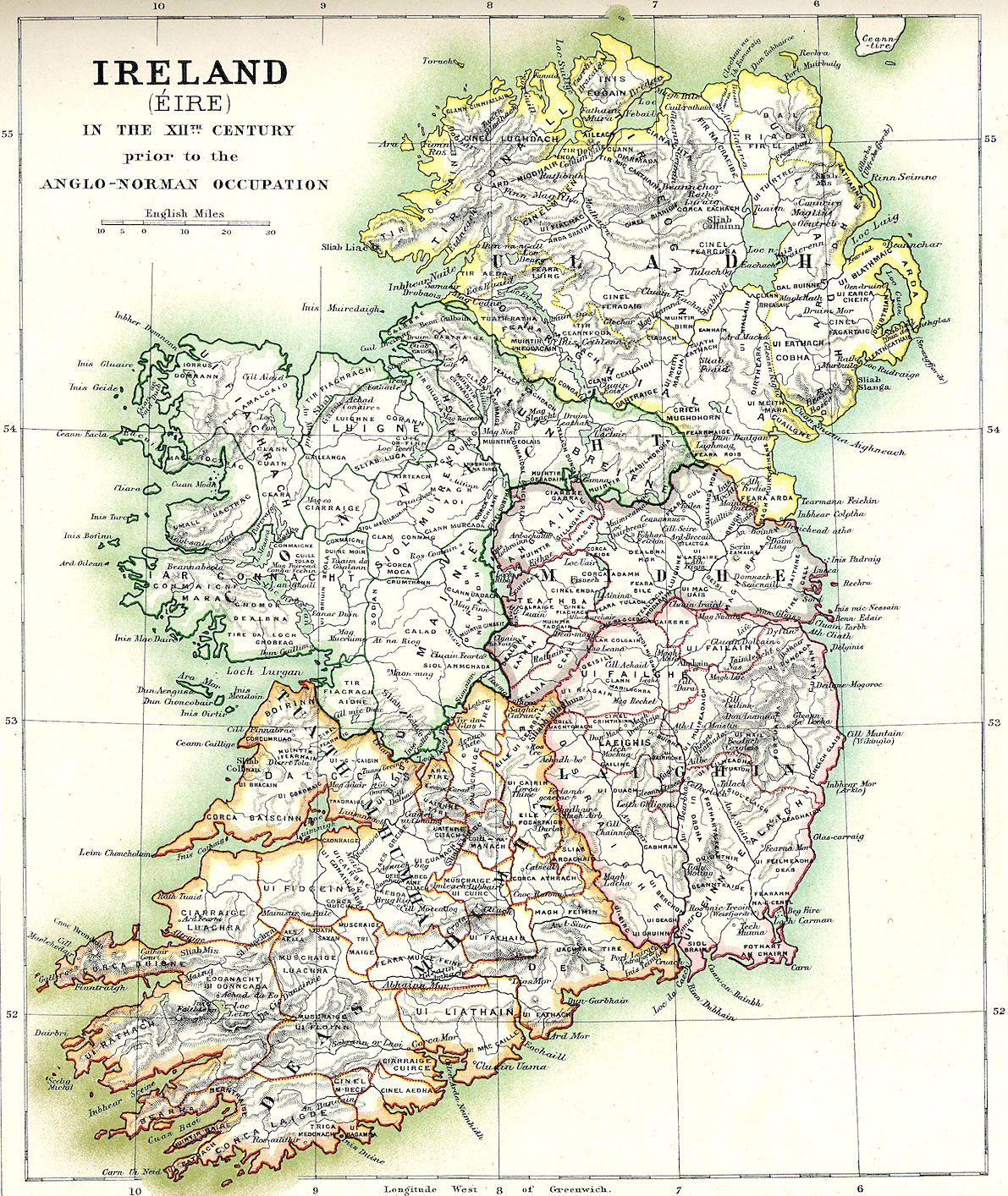
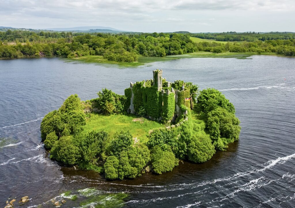
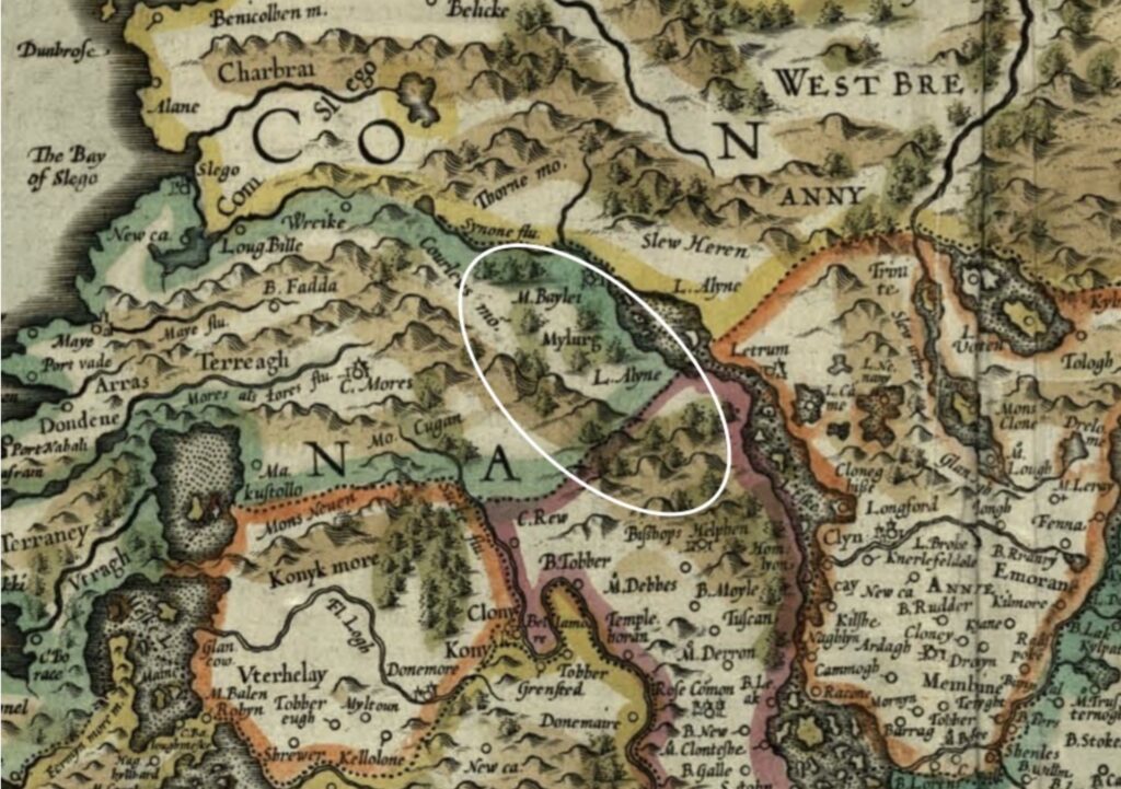
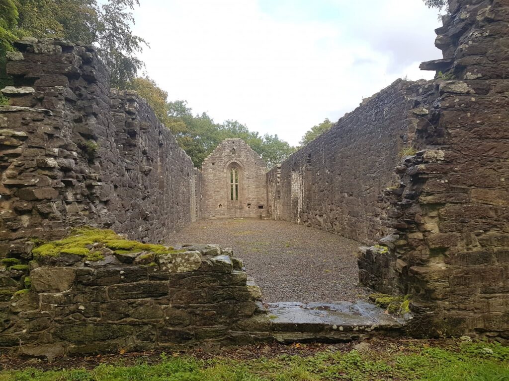
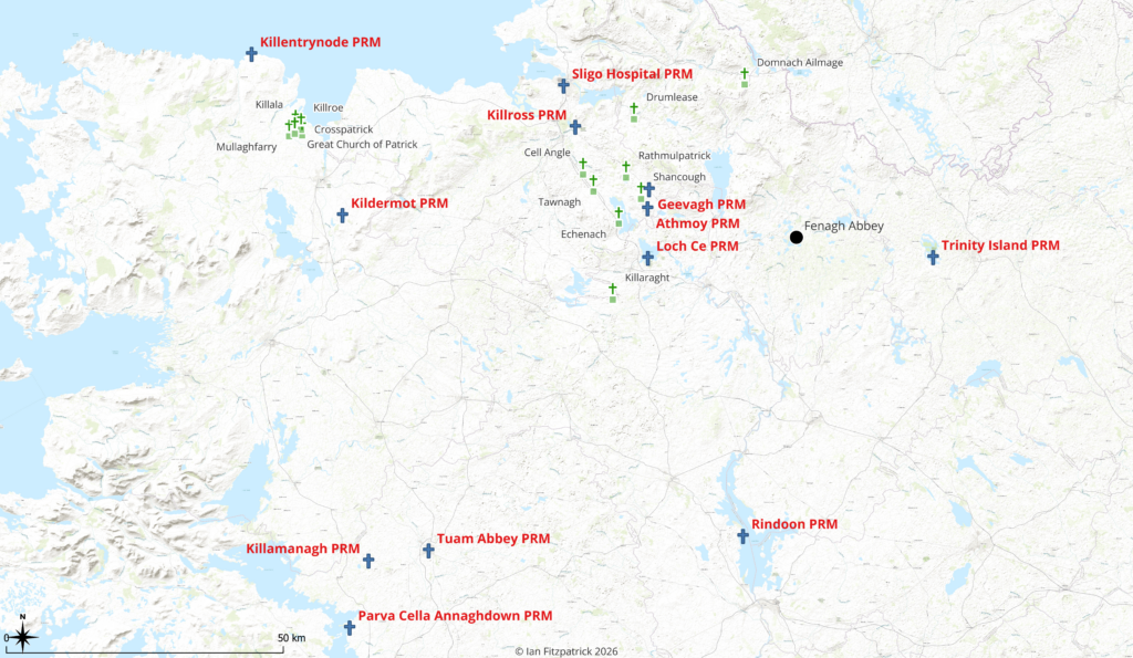
The site of Rathmulpatrick as seen from the air. Although centuries of cultivation have reduced its banks and altered its interior, the broad circular outline of the rath can still be traced within the modern fields.Ráth Mhaoil Phádraig within the archaeological landscape of southern County Sligo and adjoining parts of Roscommon and Leitrim. The red points mark records contained in the National Monuments Service Historic Environment Viewer. They include raths and other settlements, prehistoric monuments, early churches and numerous burial grounds. Several church sites experienced more than one period of use, while some graveyards continued or resumed use after the churches themselves had disappeared. The map therefore illustrates the density of settlement and religious activity surrounding Rathmulpatrick.Map showing the early Patrician church landscape around Killala and the locations of Ó Maolchonaire and several families also preserved within the wider Cenél Luacháin genealogical tradition. Their concentration within Uí Fhiachrach territory may reflect the survival of an older Conmaicne-based ecclesiastical network beneath the later political order.Approximate territories of the principal Conmaicne branches. The boundaries are interpretive and represent broad historical regions rather than fixed surveyed borders. Map by Ian Fitzpatrick, 2026.Ireland about 1160 CE, during the reign of Ruaidrí Ua Conchobair and immediately before the Anglo-Norman invasion. The provincial kingdoms are shown together with the principal political boundaries of the period. Connacht dominated the west under the Ó Conchobhair, while Moylurg was ruled by the Mac Diarmada and Bréifne by the Ó Ruairc. Within the following century, the eastern part of Bréifne would emerge as the lordship of the Ó Raghallaigh, reshaping the political landscape of the Shannon–Erne region. Carraig Mhic Dhiarmada (MacDermot’s Rock), Loch Cé. The island stronghold of the Mac Diarmada kings stood at the political heart of medieval Moylurg. By the thirteenth century, Loch Cé had become one of the most important centres in northern Connacht, where the power of the Mac Diarmada and Ó Conchobhair dynasties intersected with the reformed Church. Nearby stood Boyle Abbey, the Augustinian priory of Inchmacnerin, and later the Premonstratensian foundation of Holy Trinity established by Clarus Mac Mailín Ó Maol Chonaire, creating a remarkable concentration of political, religious and learned institutions around a single lake.The medieval lordship of Moylurg (circled) occupied a strategic position between Connacht and Bréifne. Centered on Loch Cé, it became the heartland of the Mac Diarmada dynasty and one of the principal political and ecclesiastical centres of northern Connacht. By the middle of the thirteenth century the region contained the Mac Diarmada royal residence, Boyle Abbey, the Augustinian priory of Inchmacnerin and the Premonstratensian foundation of Holy Trinity, making Loch Cé the focal point of a religious network that eventually stretched from Killala in the west to Loch Uachtair in East Bréifne.The surviving ruins of Holy Trinity Abbey on Trinity Island, Loch Cé. From this mother house, Clarus Mac Mailín Ó Maolchonaire built a Premonstratensian network that extended through Tirerrill, westward toward Killala, southward to Lough Ree and eastward into Ó Raghallaigh Bréifne at Loch Oughter.The Premonstratensian network associated with Clarus Mac Mailín Ó Maolchonaire. The map illustrates how Clarus’s confirmed foundations formed a connected chain across Connacht, following the principal medieval routeways from the Diocese of Killala through Tirerrill and Loch Cé, then eastward into East Bréifne at Trinity Island, Loch Oughter. Rather than isolated monasteries, these houses occupied strategic positions beside lakes, river crossings, roads and political centres, creating an integrated ecclesiastical network linking western Connacht with the Kilmore region. Holy Trinity at Loch Cé served as the mother house from which dependent cells and daughter foundations were administered.
The Premonstratensian churches shown in the southwest of the map, including Tuam Abbey, Killemanagh and Parva Cella Annaghdown, are not attributed to Clarus. They are included to illustrate the wider Premonstratensian presence in Connacht during the same period. It is nevertheless noteworthy that these foundations lay within, or immediately adjacent to, the historic territory of the Conmaicne Mara, highlighting the broader relationship between the White Canons and regions long associated with the Conmaicne peoples.