
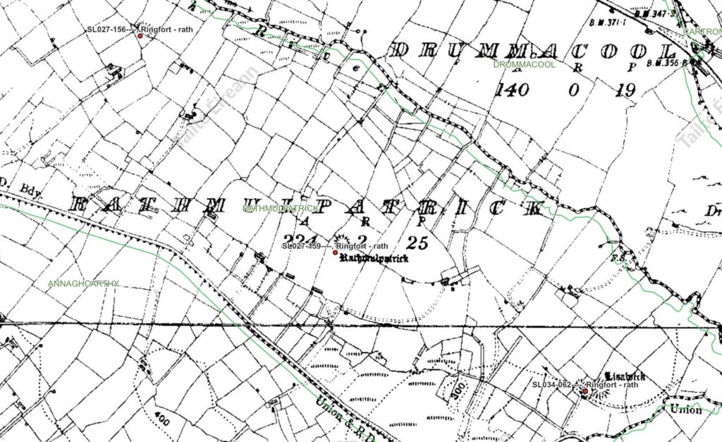
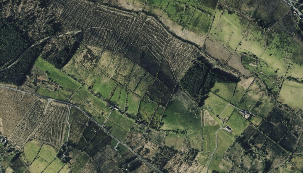
A rath was an enclosed farmstead, normally formed by a circular or oval bank of earth accompanied by an external ditch. Inside stood houses, working areas, storage buildings and enclosures for livestock. Most raths were not military fortresses in the later sense. They were places of residence, agriculture and local authority, occupied by households ranging from prosperous farming families to members of the regional elite.
The bank separated the household from the surrounding countryside while also making a visible statement about possession and standing. Constructing such an enclosure required organised labour. Its size and position proclaimed that this was an established household possessing land, livestock and a recognised place within local society. A rath was therefore more than an earthwork. It represented the family living within it and that family’s relationship with the surrounding community.
Raths were once among the most characteristic features of the Irish countryside. Hundreds have been identified within Tír Oirill alone, and several others stand close to Rathmulpatrick. The monument was therefore not unusual when it was occupied. What makes it exceptional is the survival of its name.
Most raths were constructed and occupied during the early medieval period, particularly between approximately the fifth and ninth centuries. New construction declined considerably after about AD 900, although some established enclosures remained occupied, were modified or were reused into the eleventh and twelfth centuries. The principal age of rath construction therefore coincided with the centuries in which Christianity became established and Patrician traditions were taking shape across northern Connacht. Ringforts are generally interpreted as the enclosed homesteads of early medieval farming households, although their size, complexity and the standing of their occupants varied considerably.
This chronology matters when considering the name Ráth Mhaoil Phádraig. A name identifying the enclosure with a person called Máel Pátraic was most naturally formed while the rath remained occupied, while it still functioned as part of the local settlement system, or during the generations after its abandonment when the identity of its inhabitants was still remembered. The name may therefore have originated broadly between the later early medieval period and the beginning of the high medieval period, although no exact date can be recovered.
The first element, ráth, identifies the enclosure. The second, Mhaoil Phádraig, is the genitive form of Máel Pátraic, a personal name meaning a devotee or servant of Patrick. The most direct reading is therefore “the rath of Máel Pátraic.” It does not necessarily mean “the rath of the Ó Maol Phádraig family,” because Máel Pátraic existed as a personal name before Ó Maol Phádraig became established as a hereditary surname.
Nevertheless, the possibility that an ancestral Ó Maol Phádraig household lived here cannot be dismissed. Some raths remained occupied or were reused during the period in which hereditary surnames were emerging. A man called Máel Pátraic could have occupied the enclosure, and his descendants could conceivably have become known as the Uí Mhaoil Phádraig—the descendants of Máel Pátraic. If so, Rathmulpatrick might preserve the residence of the individual or household from whom a local Ó Maol Phádraig line developed.
There is presently no documentary or archaeological evidence proving that this occurred. No surviving record names an Ó Maol Phádraig as the occupant of Rathmulpatrick, and the placename by itself cannot establish a genealogical connection. The Máel Pátraic remembered in the name could have been an individual landholder, a cleric, a member of a religious household or a person otherwise associated with the cult of Patrick. The site could also have belonged to a Patrician church or ecclesiastical estate without ever being occupied by a hereditary Ó Maol Phádraig family.
The responsible conclusion is therefore that Rathmulpatrick is a plausible but unproven location for an early Ó Maol Phádraig household. Its name is consistent with the presence of a man called Máel Pátraic, and its chronology overlaps with the period during which hereditary surnames began to form. That makes the site highly relevant to the history of the name, but it does not establish it as the original home of the family.
Most ringforts were eventually abandoned. Their banks were lowered, their ditches filled and their enclosed spaces absorbed into later fields. The identities of their inhabitants were usually forgotten, and most individual raths never retained distinctive names. At Rathmulpatrick, however, the word ráth remained joined to the name Máel Pátraic. The placename therefore preserved the memory of a particular enclosure and a particular human association long after the buildings within it had disappeared.
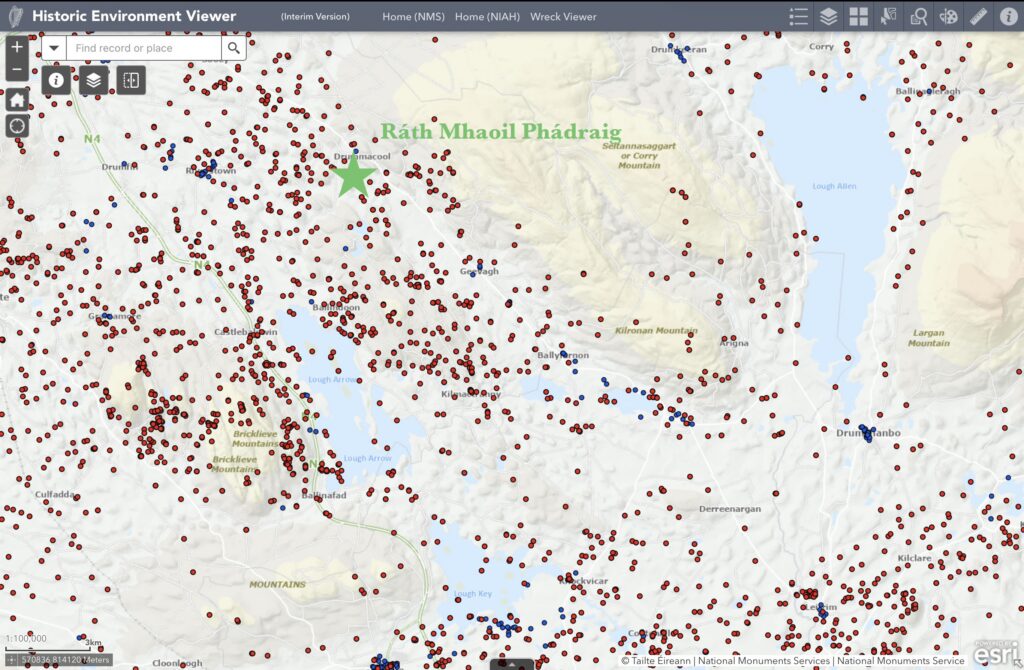
The regional map places that enclosure within its proper surroundings. It was produced from the Historic Environment Viewer, maintained by the National Monuments Service. The viewer provides online access to the Sites and Monuments Record of the Archaeological Survey of Ireland, together with other archaeological and architectural datasets. Sites and Monuments Record entries that have been precisely located appear as red points on the map.
The red points do not represent raths alone, and they do not all belong to one period. They mark recorded archaeological monuments of many different kinds. Among them are ringforts, prehistoric tombs, cairns, standing stones and other remains, but a substantial number are also early church sites and burial grounds. Some of these churches were used, abandoned and then used again during later centuries. In many cases the church itself disappeared while the surrounding graveyard continued in use, was revived after a period of abandonment, or remained locally remembered as an ancient burial place.
The concentration of old churches and graveyards shows that this was not only a farming district but also an important religious landscape. Christian communities repeatedly returned to particular places for worship and burial, sometimes over many centuries. A graveyard could preserve the sacred identity of a site long after its original timber or stone church had vanished.
The map therefore records several overlapping histories. Some monuments belong to prehistoric communities, others to the early medieval settlement represented by the raths, and many to successive phases of Christian worship and burial. The red dots should not be imagined as places all occupied at once. Together, however, they reveal the number and variety of settlements, churches and burial places that existed across the district.
Rathmulpatrick stood within this network of enclosed households, churches and graveyards. Its proximity to so many ecclesiastical sites strengthens the possibility that its Patrick-related name arose within an active Christian community rather than being attached casually to an unidentified ancient earthwork in a much later period.
The nearby raths are especially important because each ordinarily represents a settled household and its agricultural lands. Their distribution indicates that the lowlands and valleys of southern Tír Oirill supported numerous farming communities during the early medieval period. Rathmulpatrick formed one part of this network of households, kin groups and local territories.
Its geographical position also mattered. Rathmulpatrick was not isolated from the neighbouring ecclesiastical centres. Shancough lay approximately five kilometres away in a direct line and could probably have been reached on foot in about an hour and a half. Tawnagh was approximately six kilometres away and was likely a walk of between one and a half and two hours. These were nearby places with which regular contact was entirely practical.
Loch Cé lay farther to the south, but it was still within the normal range of regional movement. The northern part of the lake district was probably three to four and a half hours away on foot, depending on the route and destination, while Boyle and the settlements farther south could require most of a day. The exact paths used in the early medieval period cannot be reconstructed, and travel times would have varied according to bog, woodland, streams and seasonal conditions.
These distances place Rathmulpatrick within easy reach of Shancough and Tawnagh and within a day’s travel of the Loch Cé world. Clerics, related households, foster families, marriage partners and learned families could move repeatedly between these places. The geography therefore supports the possibility of regular contact and later family connections across the wider region.
Nearby communities would have exchanged livestock, agricultural produce, labour, marriage partners, political support and religious patronage. Christian missionaries and church founders entered this existing social world and depended upon its landholders for land, protection, food and continuing support.
Later Patrician writings describe Christian expansion through encounters with local rulers, the baptism of communities and grants of land for churches. These texts were written generations after the historical Patrick and cannot be read as eyewitness accounts of the fifth century. They nevertheless reveal that early medieval churchmen understood Christian foundations as being established through relationships with existing communities and landholders.
The survival of the name Máel Pátraic at this particular rath may preserve one such relationship. It could recall a Christian landholder, a clerical household, an early supporter of a Patrician church or, possibly, an ancestor of an Ó Maol Phádraig lineage. The evidence does not yet allow one explanation to be chosen with certainty. What can be said is that the name arose from a meaningful association between this enclosure and Máel Pátraic—an association strong enough to survive after almost all memory of the rath’s occupants had disappeared.
At this stage, the importance of these distances can only be hinted at. As the story develops, the closeness of Rathmulpatrick to Shancough, Tawnagh, Loch Cé and the surrounding church communities will become increasingly significant. Families connected with these places did not remain isolated from one another. Relationships were formed through church service, landholding, marriage, fosterage and learned tradition, and some of those connections would endure for centuries.
References
Etchingham, Colmán, and Catherine Swift. “Early Irish Church Organisation: The Case of Drumlease and the Book of Armagh.” Breifne 10, no. 37 (2001).
National Monuments Service. Historic Environment Viewer. Archaeological Survey of Ireland, Department of Housing, Local Government and Heritage, Government of Ireland.
Ordnance Survey Ireland. Historic Six-Inch Ordnance Survey Map of County Sligo, nineteenth century. Displayed as the underlying historical map in the National Monuments Service Historic Environment Viewer.
Stout, Matthew. The Irish Ringfort. Dublin: Four Courts Press, 1997.
The Heritage Council. Farming and Archaeology. Kilkenny: The Heritage Council, 2006.
Townlands.ie. “Rathmulpatrick,” “Shancough,” and “Tawnagh” townland mapping entries. Used to compare their mapped positions and estimate approximate direct distances. Walking times in the article are modern estimates rather than documented medieval journey times.